_Special Announcement Conejo OS Challenge Social Media ONLY
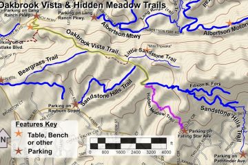
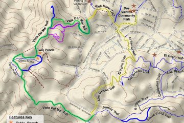
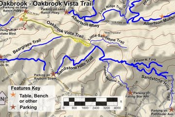
It’s New Map Monday: Hidden Meadow and Little Sandstone Trails in Oakbrook Open Space
Highlights Little Sandstone Trail passes through what could be some of the most beautiful sandstone rock formations in the county The “Mini Tripeaks” on Little Sandstone Trail is a great place to explore the rock formations, and to stop for a snack or lunch Hidden Meadow Trail is really fun Read more