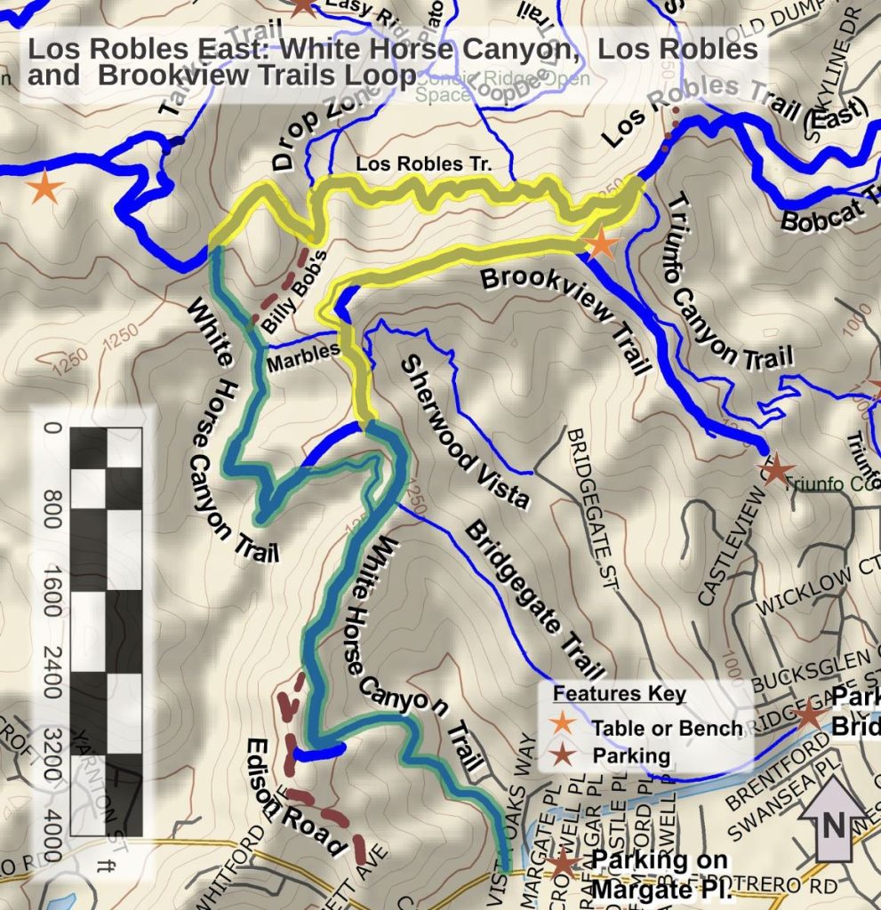
It’s New Map Monday in Los Robles East: White Horse Canyon, Los Robles and Brookview Trails Loop

Highlights
- 95% wide dirt roads
- Some good views of the Los Robles trail system, Thousand Oaks, lakes, and mountains
- White Horse Canyon Trail may be too steep for mountain bikers to enjoy climbing
- White Horse Canyon Trail is a of the segments of the 2023 Conejo Open Space Challenge, colored green on the map
Description
This moderate route includes diverse terrain including trails along the ridgeline, in the canyons, and along the hillsides. Being some distance from popular trailheads that have lots of parking, these trails are less used than other parts of the Los Robles Trail system.
Key Statistics
Distance: 5.8 miles, including the segment along Potrero Road from parking to the trailhead
Cumulative Climbing and Descent: About 1000’
Popularity: These trails are less popular but you are still likely to see other people on this route.
Parking: Free on Margate Place
For all the details including an elevation profile and photos, download the printable full PDF guide.
For complete details on this trail guide and other new ones, go to https://cosf.org/trails/trail-guides/


0 Comments