It’s New Map Monday: Oakbrook Vista Trail
Highlights
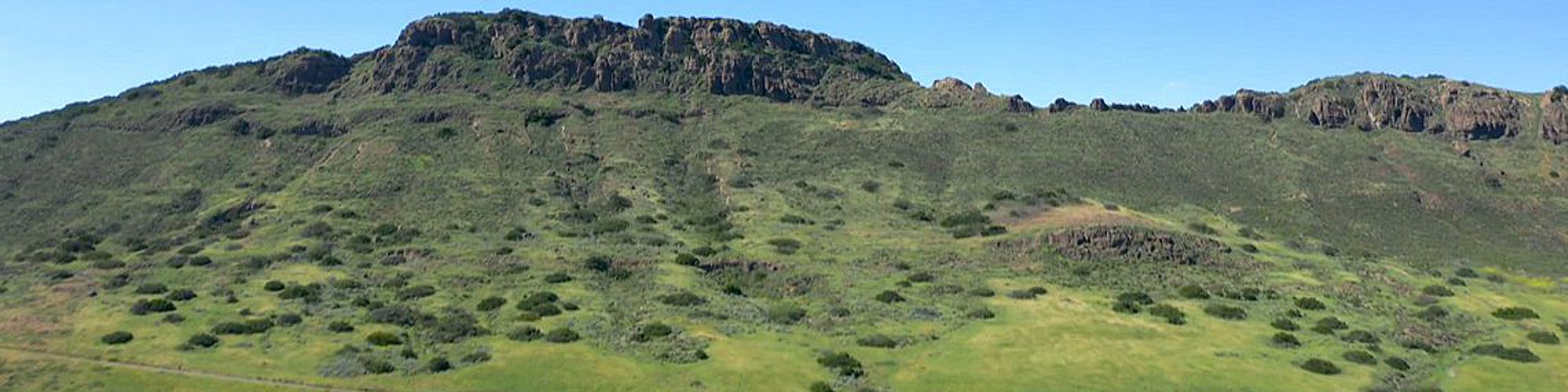
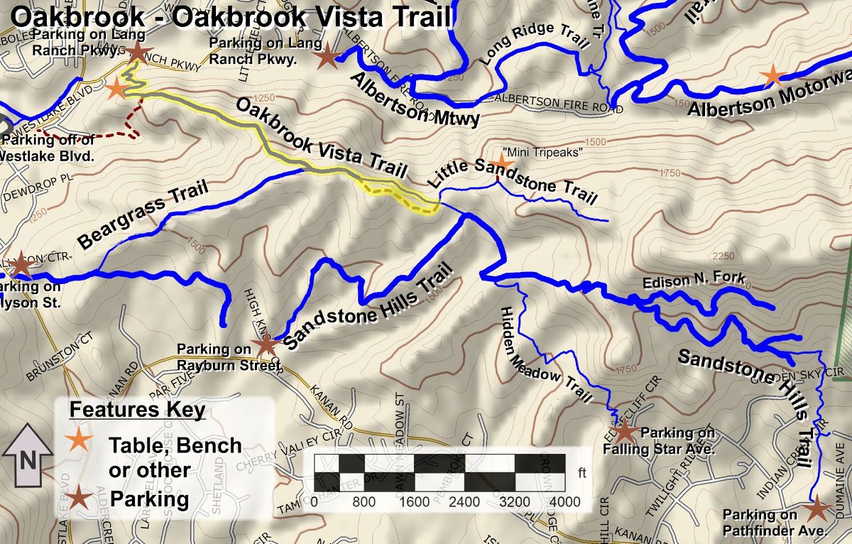
- This short out-and-back hike quickly gains elevation to give a good view over Oakbrook Regional Park and Lang Ranch Open Space to the north. You’ll get a great view of Albertson Motorway as it winds it’s way up the hills.
- In spring, the trail is lined with blooming purple sage in the lower sections, and other flowers higher up
- For the more adventurous, you can take the ridgeline trail that parallels the last 1500′ of the trail
Description
The route is only 2.7 miles in total, but the trail is moderately steep for the first 0.8 miles, so there are some calories to be burned here! Once at the top, there’s a great view of Oakbrook Regional Park below, including Albertson Motorway as it winds its way up towards China Flat.
At 1.1 miles from the start, the trail splits. To the left is the actual trail and straight ahead is a rugged trail that follows the ridgeline up and then steeply down to rejoin the trail. If you’re feeling a little adventurous, and would like to get the best views, you can take this rugged trail on your way out, or back, or both. The ridgeline trail is not appropriate for mountain bikes because of the rough nature and steepness.
Key Statistics
Distance: 2.7 miles
Cumulative Climbing and Descent: About 800′
Parking: Free on Lang Ranch Parkway at the trailhead
For all the details including an elevation profile and photos, download the printable full PDF guide.
For complete details on this trail guide and other new ones, go to https://cosf.org/trails/trail-guides/

0 Comments