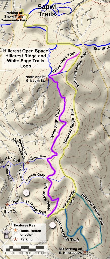
It’s New Map Monday: White Sage & Hillcrest Ridge Loop in the Hillcrest Open Space area
Highlights
- Hike of 6.6 Miles, extendable to 8 miles
- Hillcrest Ridge Trail is a ridgeline trail and is very steep in sections – you’ll get a great workout!
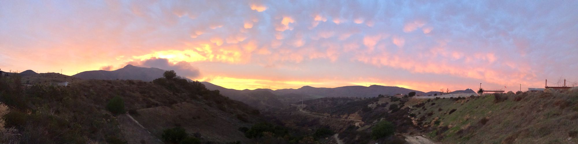
- You can get great views of the neighborhoods and distant mountains in all directions from Hillcrest Ridge.
- The White Sage Trail is a segment of the 2025 Conejo Open Space Challenge (https://cosf.org/challenge; colored pink on the map below)
Description
This is moderately strenuous route with lots of steep hills. Hillcrest Ridge is great for getting a workout! The Hillcrest Open Space is surrounded by neighborhoods, so this ridgeline route gives you great views into them. You’ll probably see lots of people later in the day getting a quick workout after work.
To get a longer hike with 400′ more of climbing, go past the Hillcrest Ridge Cutoff and follow Hillcrest Ridge all the way south until it loops around and joins up with White Sage.
There are several trails on the west side that can be used to access the loop and make it shorter. The shortest would be from the north end of Grissom Street.
Key Statistics
Distance: 6.6 miles, with an option for 8 miles if you’d like something longer
Cumulative Climbing and Descent: About 1600′; or 2000′ with the south extension (green on the map below)
Popularity: These trails all see a lot of use.
Parking: Free at Sapwi Trails Neighborhood Park at the east end of Avenida De Las Flores
For all the details including an elevation profile and photos, download the printable full PDF guide.
For complete details on this trail guide and other new ones, go to https://cosf.org/trails/trail-guides/

0 Comments