Lang Ranch & Woodridge Moderate Hike – Sunset Hills, Woodridge Loop
Lang Ranch & Woodridge Moderate Hike – Sunset Hills, Woodridge Loop
Moderate 5.6 mile round trip with a total elevation gain/loss of about 1100 ft. This hike route is sometimes called the Urban Trail. It starts in Sunset Hills Open Space and includes a big loop in Woodridge Open Space. It provides views of Wood Ranch Reservoir, Simi Valley, northern Thousand Oaks, and the Tierra Rejada Valley.
How to get there: From the 23 Freeway, drive east on Sunset Hills Blvd., then north on Erbes Rd 0.7 mile to the trailhead on the right. Park in the dirt lot.
Map of This Hike

Detailed Hike Description & Photos:
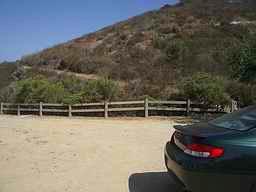 |
There is convenient off-road parking at the trailhead. Look for the dirt lot on the right.
Many species of wildlife are supported here. Some of the most commonly seen are rabbits, coyotes, roadrunners, quail, red-tailed hawks, and turkey vultures. |
|
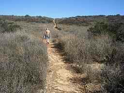 |
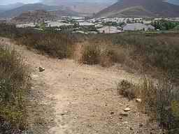
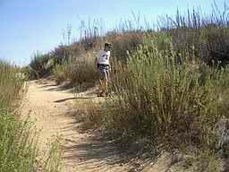
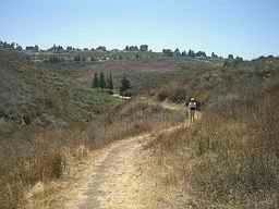
This is a well cleared trail through a coastal sage/scrub environment. Various portions of the surrounding urban area will be visible throughout the hike, which is probably why it’s sometimes called “The Urban Trail”. | |
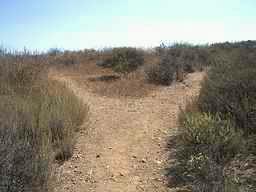 |
There are a couple of splits in the trail within the first half mile, but we want to follow the trail to the right. (The paths to the left lead to a scenic loop overlooking Wood Ranch Reservoir.) | |
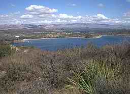 |
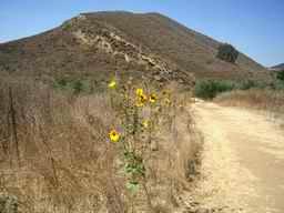
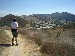
Continuing the ascent, there are wonderful views of Wood Ranch Reservoir and Simi Valley to the north-east. | |
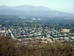 |
To the south-west is the northern portion of Thousand Oaks, | |
 |
and to the north-west is Moorpark and the Tierra Rejada Valley. | |
 |
About 1.4 miles in, a trail from the Woodridge housing development joins from the right. This begins the loop portion of the hike. To do the loop in a clockwise direction, bear to the left and continue up the hill. | |
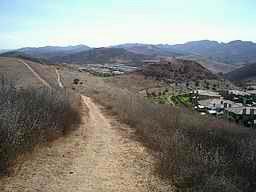 |
The trail continues with Rancho Simi Open Space on the left, and the Woodridge residential area on the right. | |
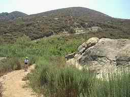 |
After walking past these interesting rock formations, you will cross a utility road. | |
 |
Soon after crossing the road, there is another trail junction. Turn sharply to the right and continue southward toward Lang Ranch. | |
 |
There is an extensive trail system in this area. For this clockwise loop, continue to bear right and follow this scenic trail toward the west. | |
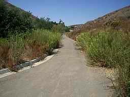 |
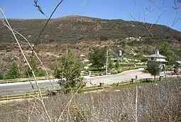
The trail becomes a paved path as it follows a creek for a while. Notice the two very different plant environments side by side – lush greenery near the creek on the left, and low dry brush on the hill to the right. | |
 |
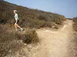
After a street crossing, it’s back to a single-track dirt trail. | |
 |
There are lots of great views along the way. This is looking back down the trail and across the Lang Ranch area. | |
 |
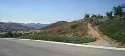
Descending toward Sunset Hills Blvd, the continuation of the trail is visible on the hill across the road. | |
 |
Shortly after crossing the road, the loop portion of the hike is complete. Turn sharply to the left for the remaining 1.4 miles of the hike. | |
 |
And finally, back down to the Erbes Road trailhead. |