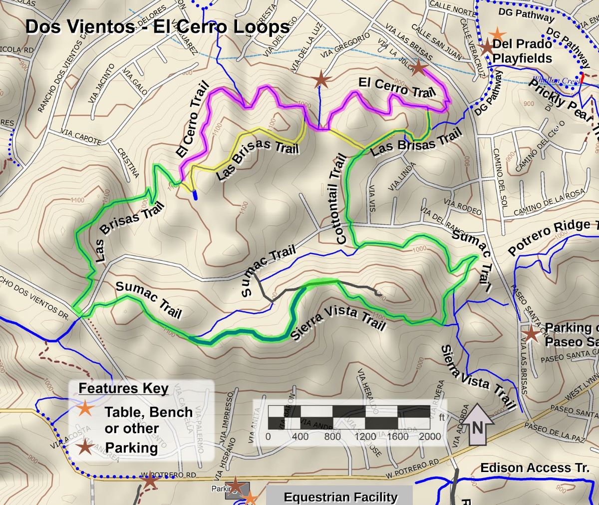
It’s New Map Monday: El Cerro Loops in Dos Vientos
Highlights
- Two routes are described here, an easy one of 2.3 miles with roughly 300′ of climbing, and a longer one of 4.1 miles with roughly 700′ of climbing
- For Dos Vientos residents, there are several nearby trailheads for easy access
- The trails climb up above the neighborhoods so you can see over them to view the mountains in the distance
- The El Cerro Trail is a segment of the 2025 Conejo Open Space Challenge (https://cosf.org/challenge; colored pink on the map below)
Description
These two loops are mostly on firm singletrack trails with easy access from nearby Dos Vientos neighborhoods (although not all access points have nearby parking). The hills are fairly gentle with the exception of about 100 yards on Las Brisas Trail where there is some erosion and possibly a thin but slippery layer of sand on the surface. This spot will be a challenge for mountain bikers. The rest is really fun to ride!
In general, there are good views everywhere.
Key Statistics
Distance: 2.3 miles or 4.1 miles
Cumulative Climbing and Descent: Estimated at 300′ for the short loop and 700′ for the longer loop
Parking: Free on Via La Jolla
For all the details including an elevation profile and photos, download the printable full PDF guide.
For complete details on this trail guide and other new ones, go to https://cosf.org/trails/trail-guides/

0 Comments