It’s New Map Monday in Oakbrook/Lang Ranch: Sandstone Hills Trail
Highlights
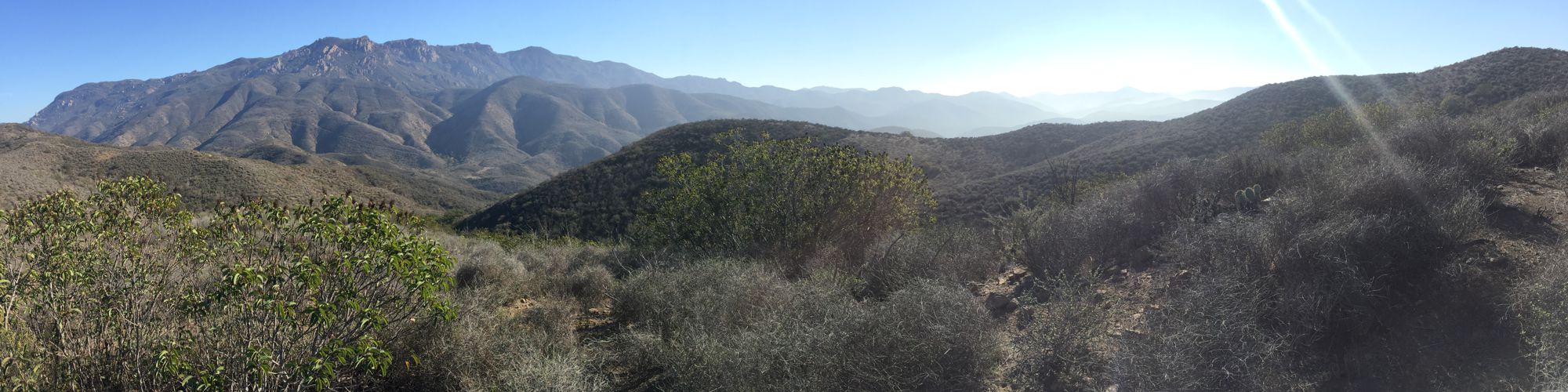
- The rocky scenery is beautiful as the trail cuts across the towering and rugged south flank of Simi Peak and the Simi Hills
- View deposits from the Middle Miocene period (14 million years ago) and Upper Cretaceous period (100 million to 66 million years ago when the dinosaurs went extinct) in the cliffs above the trail
- Experience a sea of wildflowers when conditions are right after a wet winter
- Sandstone Hills Trail is included in the 2024 Conejo Open Space Challenge
Description
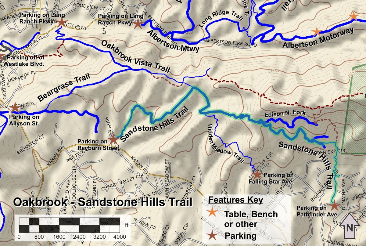
This trail is mostly an Edison Road that cuts across the very rugged south flank of the Simi Hills, and Simi Peak a little to the east. However, the eastern 0.7 miles is a sometimes uneven singletrack trail that leads down to Pathfinder Avenue. The best view of the rocks is while heading north from Pathfinder – you will be heading directly towards the cliffs. It’s amazing to think that some of the rocks you see date back to the age of the dinosaurs.
There is free parking on the street at both ends of the trail so you can do this as an out-and-back route, or car shuttle between the ends.
Although most of the trail is an Edison Road, there are short sections that are pretty steep so inexperienced mountain bikers will have a tough time.
Key Statistics
Distance: 6.3 miles, out and back
Cumulative Climbing and Descent: 1600’, out and back
Popularity: You are most likely to see other outdoor enthusiasts in the short stretch between Hidden Meadow and Oakbrook Vista Trails.
Parking: Free on both Pathfinder Avenue (east end) and Rayburn Street (west end)
For all the details including an elevation profile and photos, download the printable full PDF guide.
For complete details on this trail guide and other new ones, go to https://cosf.org/trails/trail-guides/


0 Comments